Cedar Bayou Mitigation Bank
Liberty County, Texas
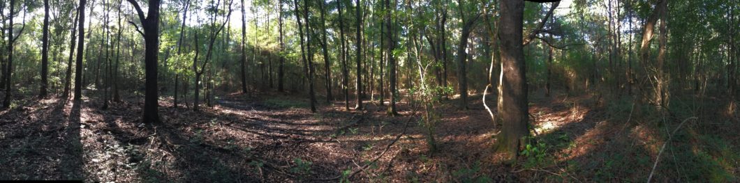
Remnant willow oak wet hardwood flatwoods proximate to the site (Photo Credit: Pamela Fetterman)
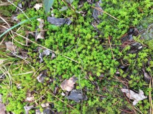
Sphagnum moss at a reference site for wet mixed pine-hardwood flatwoods. (Photo Credit: Pamela Fetterman)
This 519.20 acre wetland and stream mitigation project is proposing to restore the headwater branches of Cedar Bayou, a watershed within the greater Houston metropolitan area that eventually discharges into northern Galveston Bay. EcoGENESIS is providing mitigation work plan and MBI permitting services for this bottomland hardwood wetland and low-gradient stream restoration bank in Liberty County, Texas.
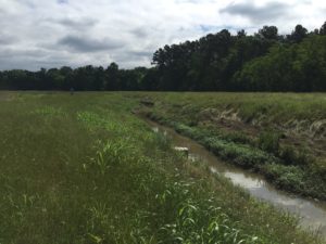
Headwater reach existing conditions. (Photo Credit: Water & Land Solutions, Inc)
The project will result in the restoration of the headwaters of Cedar Bayou, composed of three headwater branches and a portion of the main stem. EcoGENESIS is working in tandem with the stream restoration consultant, Water and Land Solutions and EcoSystem Renewal technical staff in the design and permitting of this project. This project, when implemented, has the potential to provide significant floodplain storage within a watershed prone to flooding and TMDL exceedances. The headwaters were historically impacted from dredging, channel modifications (straightening) and berming. Historic bottomland hardwood and mixed pine-hardwood wetlands were converted to commodity crop agricultural. The bank lands have been in active agricultural production for the past 70 years. The conversion of much of the Western Gulf Coastal Plain into agriculture and associated drainage ditching has resulted in significant losses of native habitats, including riparian forests that naturally occurred along low-gradient coastal streams and drainages such as Cedar Bayou (HGAC, 2016).
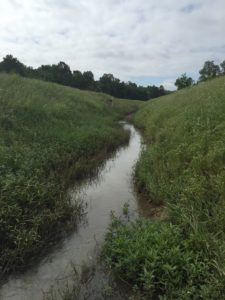
Existing conditions, unnamed tributary to mainstem of Cedar Bayou. (Photo Credit: Water & Land Solutions, Inc.)
The Bank will provide high-quality, permanently protected and restored stream and BLH habitat and significantly aid in meeting compensatory mitigation needs within the Bank’s service area. Proposed habitat types and credits consist of the following:
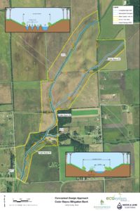
Stream restoration conceptual design. (Photo/Design Credit: Water & Land Solutions, Inc.)
- • Re-establishment of 16,488 linear feet of Cedar Bayou and its tributaries through Rosgen Priority Level 1 and Priority Level 2 restoration activities that fully restores degraded stream channel geomorphic functions;
- • Rehabilitation and Enhancement of 5,475 linear feet of Cedar Bayou and its tributaries through Rosgen Priority Level 2 restoration activities that includes in-stream structure installation, bankfull bench creation, levee removal, and bioremediation techniques;
- • The re-establishment of 75.2 acres of riparian, forested wetland buffer adjacent to Cedar Bayou and its tributaries through levee removal, re-grading and planting.
- • Re-establishment of 395.3 acres of riverine and palustrine forested wetlands comprised of bottomland hardwood floodplain, hardwood flatwood, mixed pine-hardwoods and cypress community types through re-forestation and natural recruitment of canopy and subcanopy species, nuisance/exotic species removal, and hydrologic restoration activities.
- • Rehabilitation of 0.6 acres of existing palustrine forested wetlands comprised of mixed pine-hardwoods and cypress community types through nuisance/exotic species removal, supplemental planting of canopy and subcanopy species, and hydrologic restoration activities;
- • Re-establishment of 5.4 acres of palustrine scrub-shrub wetlands through hydrologic restoration activities, planting, and natural recruitment;
- • Establishment/re-establishment of 4.6 acres of palustrine emergent herbaceous wetlands within an existing pond through re-grading to establish appropriate topography and floodplain hydrologic connectivity, and re-vegetation through planting and natural recruitment;
- • The Establishment of 0.3 acres of forested mesic hardwood upland buffer through planting of appropriate canopy species.
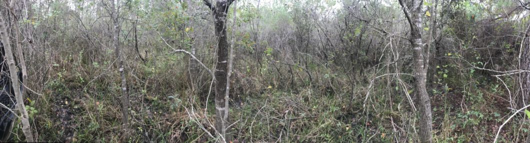
Existing forested habitat adjacent to Cedar Bayou mainstem currently cut-off from most flooding events by leeves. (Photo Credit: Jake James)